
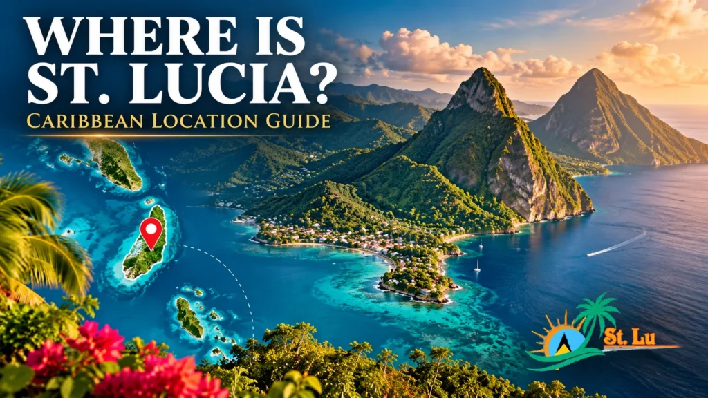
Where Is St. Lucia Located? Map, Region & How to Get There
Planning a trip and wondering exactly where St. Lucia sits? This guide pinpoints St. Lucia’s location in the Caribbean — its region, neighboring islands, map coordinates and how travelers actually reach it.
St. Lucia is one of the Caribbean’s most recognizable islands, famous for its twin Pitons, rainforest and volcanic scenery. But before you can picture yourself there, it helps to know exactly where it is — which part of the Caribbean it belongs to, what it’s near, and how far it is from home.
The short version: St. Lucia is a small island nation in the eastern Caribbean, part of the Windward Islands. Below, we break down its precise location, its position on the map, the islands around it, and the practical side of getting there and getting around once you arrive.
Where is St. Lucia located? St. Lucia is an island country in the eastern Caribbean Sea, part of the Windward Islands in the Lesser Antilles (the West Indies). It lies just south of Martinique and north of St. Vincent, with the Caribbean Sea to its west and the Atlantic Ocean to its east. Its approximate coordinates are 13.9° N, 61.0° W.
The BasicsWhere Is St. Lucia Located in the Caribbean?
St. Lucia is a sovereign island nation in the eastern Caribbean Sea. It belongs to a chain of islands called the Windward Islands, which form the southern part of the Lesser Antilles — the smaller arc of islands that curves down the eastern edge of the Caribbean toward South America. All of these islands together are part of the wider region known as the West Indies.
Volcanic in origin, St. Lucia is the second-largest of the Windward Islands and sits roughly in the middle of that chain. Its position on the eastern rim of the Caribbean is important for travelers: the calm Caribbean Sea lies along its western (leeward) coast, where most of the resorts and swimmable beaches are, while the wilder Atlantic Ocean meets its eastern (windward) coast. That single fact explains a lot about the island — why the west coast is calm and the east coast is rugged and breezy.
On the MapSt. Lucia on the Map & Its Coordinates
On a map, St. Lucia appears as a small, teardrop-shaped island toward the eastern edge of the Caribbean, roughly two-thirds of the way down the arc of the Lesser Antilles. Its approximate coordinates are 13°53′ N latitude and 60°58′ W longitude — in round numbers, about 14° North and 61° West.
To orient yourself: if you find Puerto Rico and the Virgin Islands at the top of the Lesser Antilles and Trinidad at the bottom near South America, St. Lucia sits in the lower-middle section of that chain, closer to the southern end. The island is compact — about 27 miles (43 km) long and 14 miles (23 km) wide — so wherever you stay, you’re never far from the sea.
The NeighborsWhat Islands Is St. Lucia Near?
St. Lucia has no land borders — like every Caribbean island, its only neighbors are across the water. The closest are:
- Martinique — the nearest island, lying just to the north, roughly 24 miles (about 39 km) across the Saint Lucia Channel. Martinique is an overseas region of France.
- St. Vincent and the Grenadines — to the south, about 21 miles (around 34 km) away across the Saint Vincent Passage.
- Barbados — to the east-southeast, out in the Atlantic, a short inter-island flight away. Barbados sits apart from the main island arc.
A little further afield, Grenada lies to the south beyond St. Vincent, while Dominica, Guadeloupe and Antigua continue up the chain to the north. This central position makes St. Lucia a natural hub within the Windward Islands and an easy point from which to understand the wider eastern Caribbean. If you’re weighing destinations, our guide to the best Caribbean islands compares St. Lucia with its neighbors in detail.
The RegionWindward Islands, Lesser Antilles & the West Indies
The Caribbean’s islands are grouped in a few overlapping ways, and St. Lucia belongs to several categories at once. Here’s how they fit together:
- West Indies — the broad name for all the Caribbean islands between North and South America.
- Antilles — split into the Greater Antilles (the large islands like Cuba, Jamaica, Hispaniola and Puerto Rico) and the Lesser Antilles (the smaller eastern islands). St. Lucia is in the Lesser Antilles.
- Windward vs. Leeward — the Lesser Antilles are further divided into the northern Leeward Islands and the southern Windward Islands. St. Lucia is one of the Windward Islands, so named because they catch the prevailing east-to-west trade winds.
In everyday terms, that means St. Lucia sits in the eastern (or southeastern) Caribbean — a region known for lush, mountainous, volcanic islands rather than the flat, dry islands found elsewhere. Like most of the Caribbean, it lies within the Atlantic hurricane region, with the official season running from June to November; conditions vary year to year, so it’s always worth checking seasonal forecasts when you plan.
Common QuestionWhat Continent Is St. Lucia In?
St. Lucia is an independent country, not part of any mainland, but geographically the Caribbean is generally associated with the North American continent. So while St. Lucia isn’t attached to any continent physically, it’s usually classified as part of North America (specifically the Caribbean sub-region), rather than South America — even though it lies fairly close to the South American coast.
It’s also worth clearing up a common mix-up: St. Lucia is its own country, a member of the Commonwealth with its capital at Castries. It shouldn’t be confused with places of similar names elsewhere, such as the St. Lucia estuary in South Africa — the Caribbean St. Lucia is a separate island nation entirely.
At a GlanceQuick St. Lucia Geography Facts
| Region | Eastern Caribbean — Windward Islands, Lesser Antilles (West Indies) |
| Coordinates | Approx. 13°53′ N, 60°58′ W (about 14° N, 61° W) |
| Capital & largest city | Castries (northwest coast) |
| Land area | Approx. 617 km² (238 sq mi) |
| Coastline | Around 158 km (about 98 mi) |
| Highest point | Mount Gimie, about 950 m (over 3,100 ft) |
| Nearest islands | Martinique (north), St. Vincent (south), Barbados (east) |
| Surrounding water | Caribbean Sea (west), Atlantic Ocean (east) |
| Airports | Hewanorra Intl (UVF, south) & George F. L. Charles (SLU, Castries) |
| Official language | English |
| Currency | East Caribbean dollar (XCD) |
| Calling code | +1 758 |
Figures are approximate and rounded; sources vary slightly on exact area and elevation.
Island LayoutKey Areas of St. Lucia & Where They Sit
Because St. Lucia is small but mountainous, knowing the layout of the island helps you picture where things are — and plan your time. The main areas run roughly north to south:
- The north (Castries, Rodney Bay, Gros Islet, Cap Estate): the island’s most developed area, home to the capital, the cruise port, the liveliest beaches and much of the nightlife and dining.
- The central-west coast (Marigot Bay, Anse La Raye, Canaries): a scenic stretch of sheltered bays and fishing villages along the Caribbean side.
- The southwest (Soufrière & the Pitons): the island’s scenic heart — the twin Pitons, Sulphur Springs, waterfalls and rainforest, and some of its most famous resorts.
- The south (Vieux Fort): home to the main international airport and breezy Atlantic beaches popular with kitesurfers.
If you want ideas for what to see across these areas, our guides to the best places to visit in St. Lucia and the island’s best beaches break each region down further.
Getting ThereHow Do You Get to St. Lucia?
Despite sitting in the eastern Caribbean, St. Lucia is well connected. Most international visitors arrive by air, and the island has two airports:
- Hewanorra International Airport (UVF) — in the south near Vieux Fort, this is the main gateway for long-haul and international flights from the US, Canada and the UK.
- George F. L. Charles Airport (SLU) — in Castries in the north, mainly serving shorter regional and inter-island flights from places like Barbados, Martinique and Trinidad.
From the US East Coast, St. Lucia is roughly a four-to-five-hour flight, with nonstop service from several major hubs; travelers from elsewhere often connect through a nearby Caribbean island or a US gateway. Many visitors also arrive by cruise ship, docking near Castries in the north. Whichever way you arrive, your first task on the ground is getting from the airport to your hotel — and because the airports sit at opposite ends of the island, that transfer time depends heavily on where you’re staying.
Arriving in St. Lucia? Start your trip the easy way.
The two airports sit at opposite ends of a mountainous island, so transfer times vary a lot. A pre-booked private transfer means a driver is waiting when you land, with a fixed price and no guesswork. See why travelers rate our team so highly.
Book an Airport Transfer →On the IslandGetting Around Once You Arrive
St. Lucia’s location gives it dramatic terrain — a central ridge of forested mountains rising to Mount Gimie — which is beautiful but means the roads are narrow and winding, especially on the route south toward Soufrière and the Pitons. Distances look short on a map, yet travel times can be longer than expected.
Public minibuses are inexpensive but run set routes on their own schedule, so for comfort and flexibility many visitors use a private taxi or a private island tour. A local driver-guide who knows the mountain roads can link the airport, your hotel and the island’s highlights into one smooth day — which, on terrain like this, makes a real difference.
FAQWhere Is St. Lucia? Frequently Asked Questions
Where is St. Lucia located?
Is St. Lucia in the Caribbean?
What islands are near St. Lucia?
What ocean surrounds St. Lucia?
What continent is St. Lucia part of?
Is St. Lucia its own country?
How far is St. Lucia from the United States?
Which airport should I fly into for St. Lucia?
Now You Know Where It Is — Ready to Explore St. Lucia?
From the airport to the Pitons, the beaches and beyond, a local driver-guide helps you experience St. Lucia comfortably — on your own schedule, without navigating the mountain roads yourself.